Leave no stone unturned with the suite of vegetation mapping tools
At kindwise, we have mastered several approaches to vegetation mapping, proven across a wide range of environments and use cases. Choose the method that best fits your project.
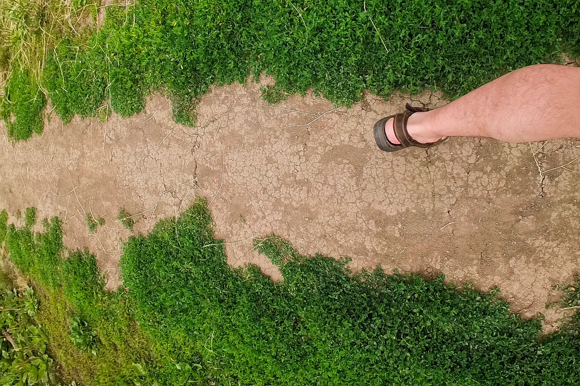
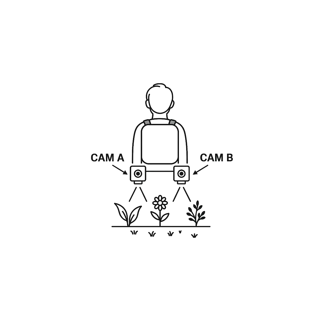
Backpack Camera Mapping
A lightweight phytosociological survey that captures even the tiniest plants. A downward-facing camera, mounted 1 m high, captures a frame roughly every meter; plant.id is used to tag each species and our pipeline georeferences every detection. The result is a GIS layer you can drop straight into QGIS or ArcGIS. With this method, we can identify up to 30,000 different plant species.
Successfully field-tested in a meadow near Brno. A case study focused on forest understory mapping, georeferenced but without LiDAR—is currently in preparation.
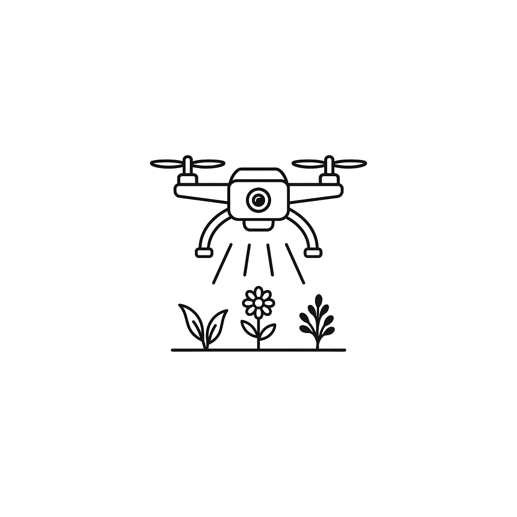
Drone Mapping
We support two workflows:
1) Standard workflow: If your imagery meets or exceeds 1 mm ground sampling distance (GSD)— typically achieved at ~5–10 m flight height with a high-res camera, we run it directly through our pre-trained plant.id models and deliver a GIS-ready species map. With this method, you can identify up to 30,000 plant species; however, identification is reliable only for larger plants.
Cost: ~€9 per ha, minimum area 200 ha.
2) Custom workflow: For coarser imagery, we first fine-tune a bespoke model tailored to your habitat, then generate the same GIS-ready output. Contact us.
Successfully deployed in the Namib Desert; a pilot in the Milovice grasslands is currently under way in the Czech Republic.
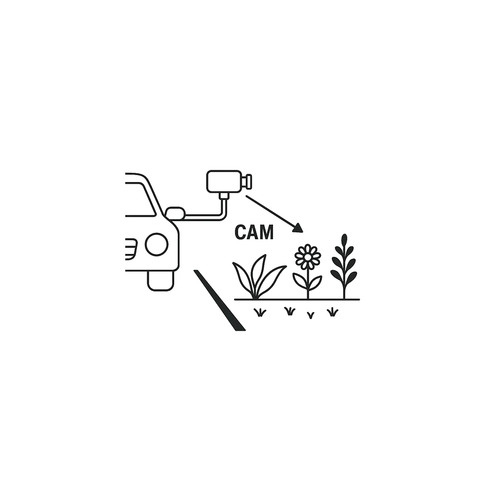
Roadside Vegetation Mapping
Using simple dash cams mounted on a moving vehicle, we map conspicuous flowering species along roadsides—ideal for tracking invasives like large-leaved lupine (Lupinus polyphyllus). The footage is sampled, processed through plant.id, and delivered as a georeferenced species layer.
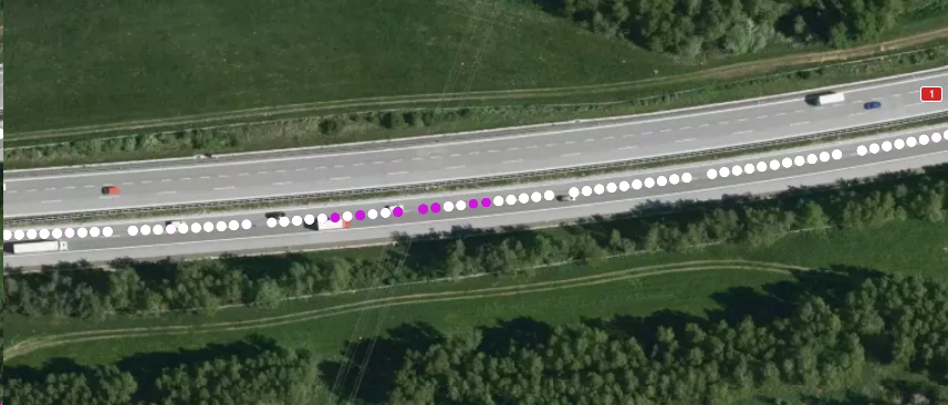
Validated by the Institute of Botany, Czech Academy of Sciences (Brno), using low-cost cameras.
Related product: roadside.vision, a tool for mapping roadside trees.
Per‑Tree Forest Mapping
Forestum.ai (our forest analytics branch) transforms drone imagery (optionally combined with ground-based LiDAR) into per-tree data: precise location, species, height, diameter at breast height, and estimated timber volume. A recent validation showed that while it identifies approximately 65% of trees, those detections represent 88% of total stand volume: giving forest managers the metrics that matter most.
Field trials include a mixed stand in Adamov, Czech Republic, and a coniferous site in Tiainen, Finland.

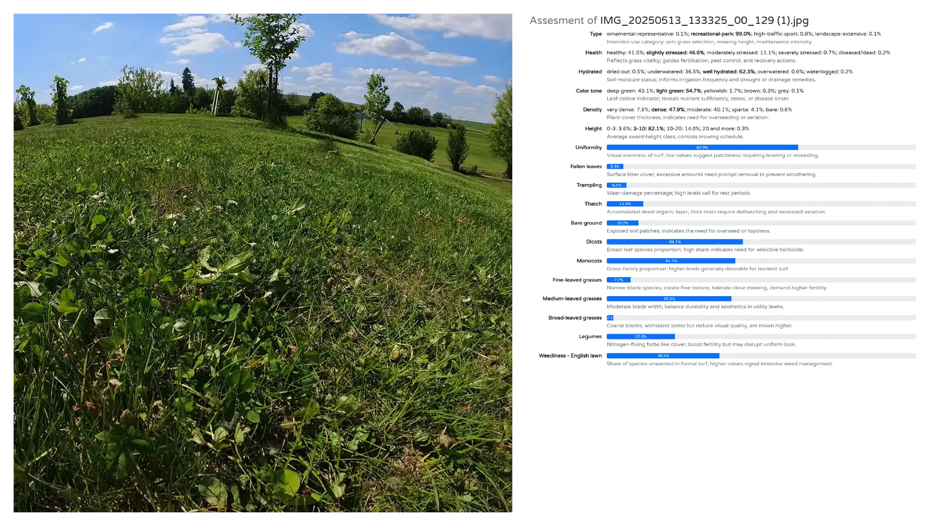
Turf Insights
Ground-level imaging on mowers or robots enables turf-health monitoring. The model scores turf type, health, hydration, density, height, thatch, weed ratio, trampling, bare soil, and biodiversity, and flags human presence (GDPR-compliant processing, e.g., anonymization/blur) or obstacles. The output includes geo heat maps to support precision maintenance.
Why kindwise?
Powered by the plant.id engine (continuously trained on field photos since 2013 and available as an API since 2018), kindwise has spent over a decade advancing AI-based plant recognition, earning citations in peer-reviewed research and industry projects. We’ve now taken that proven technology and purpose-built it for large-scale vegetation mapping, transforming ordinary imagery into GIS-ready species layers in just days.